
Bến Tre province
Bến Tre province
Tỉnh Bến Tre | |
|---|---|
 Bến Tre countryside around Cái Mơn | |
 Seal | |
| Nickname: Bamboo Landing | |
 Location of Bến Tre within Vietnam | |
 | |
| Coordinates: 10°10′N 106°30′E / 10.167°N 106.500°E | |
| Country | |
| Region | Mekong Delta |
| Capital | Bến Tre |
| Government | |
| • People's Council Chair | Nguyễn Hữu Phước |
| • People's Committee Chair | Nguyễn Thị Thanh Hà |
| Area | |
| • Total | 2,379.70 km2 (918.81 sq mi) |
| Population (2023) | |
| • Total | 1,799,328 |
| • Density | 760/km2 (2,000/sq mi) |
| Demographics | |
| • Ethnicities | Vietnamese, Khmer, Hoa, Chăm |
| GDP[2] | |
| • Total | VND 41.851 trillion US$ 1.818 billion |
| Time zone | UTC+7 (ICT) |
| Postal code | 86xxx |
| Area codes | 75 (until 16 July 2017) 275 (from 17 June 2017) |
| ISO 3166 code | VN-50 |
| Website | www |
Bến Tre (Vietnamese: [ʔɓen˧˦ ʈɛ˧˧] ) is a province of Vietnam. It is one of the country's southern provinces, and is situated in the Mekong Delta. It is also famous for its coconuts and the Coconut Religion nationwide.
Etymology
[edit]Bến Tre was sparsely populated by the Khmer people for centuries before the arrival of the Vietnamese people to these swampy lands. The name that these early Khmer settlements chose for what we now call "Bến Tre" was "Srôk kompong Trey" or "Sóc Treay" by the Vietnamese (meaning "land of the abundance of fish").
Due to the influx of Vietnamese and Chinese immigrants from Central Vietnam and other regions, people began to misprounce the province's name so that now it is colloquially known as "Bến Tre".
The name also litterally translates in Vietnamese as (Harbor "Bến" of Bamboos "Tre")
History
[edit]Early history
[edit]As far back as early 16th century, the Bến Tre region was an untamed land with marshes, jungles, teaming with crocodiles, tigers, intermingled with a grid of ditches and streams. Then, waves of migration throughout Post-Angkor period had been gradually forming. It was those migrants from many parts of Vietnam, who came to Bến Tre from long distance that would define the region.
Nguyễn Dynasty
[edit]From the very early history, the people were unyielding to the natural environment. In 1757, Bến Tre was designated as Tân An governate by the Nguyễn lords.[3]During the time of the Tây Sơn wars, the people took part in fighting against the Siamese (today's Thailand) forces who were "invited" in by Gia Long in the civil war between Đàng Trong (the Interior Territory, the South) and Đàng Ngoài (the Exterior Territory, the North).
During the reign of Minh Mạng in the 1820s, the region of Bến Tre comprised of Hoàng Trị Phủ (Governate) under the administration of Vĩnh Long province. Later in 1847, Hoàng Trị was split into Hoằng An and Hoằng Trị.
French colonial era
[edit]In 1858, the French started their colonial rule in Indochina by invading Vietnamese territory in the Sơn Trà Mountain. 4 years later, in 1862, conceding defeat, the feudal government gave the French Empire 3 of the 6 provinces of the south, including Bến Tre. In 1867, the colonialists established an Inspection office (sở tham biện) in the town of Bến Tre.
In 1900, Governor-General Paul Doumer odered that all inspection offices be merged to create what today's Bến Tre province is.
1945 to 1975
[edit]At the start of the Vietnam War in early 1960, the people of took up arms in what later turned out to be one of the most resounding uprising in the war: The Đồng Khởi Movement (The Simultaneous Uprising).
Throughout more than one month of successful uprising, from January 17th to February 26th, 1960, the communist and revolutionary elements attacked and took temporary control of several districts in Bến Tre, then known as Kiến Hòa.[4] The rebels set up "people's revolutionary committees", and confiscated lands from landlords and redistributed it to poor farmers. One of the leaders was Madame Nguyễn Thị Định, who led the all-female "Long Hair Army".
Although the Army of the Republic of Vietnam recaptured the villages, uprisings spread to many other areas of South Vietnam. The uprisings were spontaneous rather than planned, as the official policy of the socialist government in Hanoi was that the southern rebels' stance should be restrained and defensive, not offensive.[5]
On May 1, 1975, the provincial town of Bến Tre fell to the National Liberation Front's Army of South Vietnam and the whole province would be unified with rest of Vietnam
Modern era
[edit]Today, in the new wave of economic and social changes sweeping across the nation, the Communist Party of Vietnam aims at breathing in new life into one of the country's poorest regions. Rạch Miễu Bridge, Hàm Luông Bridge, Ba Lai Flood Control Dam, a grid of new large roads connecting Bến Tre to its neighbouring provinces, and many industrial zones and complexes such as the Giao Long Industrial park, etc, are some of the province's ambitious projects under construction. Once finished, all these projects would contribute greatly to lifting the face of the province.
Administration
[edit]Bến Tre is subdivided into 9 district-level subdivisions. The eight districts are Ba Tri, Bình Đại, Châu Thành, Chợ Lách, Giồng Trôm, Mỏ Cày Bắc, Mỏ Cày Nam, and Thạnh Phú. There is also one provincial city of Bến Tre (capital). They are further subdivided into 7 commune-level towns (or townlets), 147 communes, and 10 wards. See also List of communes in Bến Tre province.
Legislative
[edit]The people of Bến Tre will elect delegates to ward, commune, district and provincial People's Councils every 5 years. The current administration is apart of the 15th National Assembly. The Councils will pass resolutions (nghị quyết) according to the law.
The Chairwoman of the Provincial People's Council is Hồ Thị Hoàng Yến with Vice Chairmen being Huỳnh Văn Triệu and Lê Văn Khê.
Executive
[edit]The People's Councils at all levels will elect the members of the People's Committees every 5 years. The Committees will act upon the earlier resolutions and govern.
The Chairman of the Provincial People's Committee is Trần Ngọc Tam with Vice Chairmen/Chairwomen being Nguyễn Minh Cảnh, Nguyễn Trúc Sơn and Nguyễn Thị Bé Mười.
Geography
[edit]
Geographically speaking, Bến Tre is wedged between the two main branches of the Tiền Giang River, which is itself one of the two main branches of the Mekong river. The province's northern boundary is formed by the Tiền Giang's main course, while the province's southern one is formed by the Tiền Giang's largest branch (which breaks away from the Tiền Giang just upriver from Bến Tre province). Between the Tiền Giang and its main branch are two smaller branches, passing through the middle of Bến Tre.
The entire province is criss-crossed with a network of smaller rivers and canals. The extensive irrigation that this provides makes Bến Tre a major producer of rice, but also means that the area is prone to flooding. The Climate Change Research Institute at Cần Thơ University, in studying the possible consequences of climate change, has predicted that 51% of Bến Tre province can be expected to be flooded if sea levels rise by 1 meter.[6] Bến Tre province is, on average, only 1.25 meters (4 ft 1 in) above sea level.
Climate
[edit]Bến Tre belongs to the tropical monsoon climate, which is characterized by strong monsoon influence and rather high and stable temperature all year round, ranging around 26 °C (79 °F). On the yearly basis, the province witnesses the Sun passing the zenith two times on April 16th and July 27th.
Being in the tropical zone also endows Bến Tre with a majority of sunny days in the year. Though it is located ashore the South China Sea, in general Ben Tre is rarely affected by tropical storms and typhoons from the Pacific Ocean, not as much as other parts of Vietnam, especially Central Vietnam and the Northern Vietnam.
Like other Southern provinces, Bến Tre has two distinguished seasons in the year. The dry season, typical of cold north-eastern winds, lasts from December to April the next year. Then comes the wet season from May to November, with a lot of rain and high humidity as a result from the influence of tropical monsoon (south-western wind). During the wet season, the rainfall is hovering as high as 1,250mm to 1,500mm, while in the dry season, this is as little as 2% to 6% of the whole year.
There are advantages and disadvantages stemming from this climate pattern. With much exposure to sunlight, high temperature and humidity are good for photosynthesis and reproduction of plants and livestocks. Disadvantages, however, caused by those good features themselves, results in the development of pests, diseases, and an assortment of fungi all year round.
Moreover, the dry season also causes the biggest problem: the invasion of salt-water leading to soil salinity and drought. The shortage of fresh water for production and clean water for living activities causes bad effects on cultivation and life in seaside areas such as Bình Đại, Ba Tri, Thạnh Phú [7]
Healthcare
[edit]Education
[edit]Economy
[edit]Bến Tre is well known as the "Coconut Capital of Vietnam", with the largest area of coconut coverage in the country. In 2018, the coconut area reached over 72,000 ares (7.2 km2), accounting for 42.5% of the total national coconut area and 0.6% of the global coconut area. Ben Tre’s coconut yield is more than 600 million coconuts. Especially, the province has a variety of coconut species with good quality and high productivity, so the it accounts for 47.34% of the national and 0.9% of the global coconut production output, respectively.
Bến Tre’s coconut process industry, which has been considered as a key economic sector of the province, has developed rapidly and abundantly in commodities, accounting for a large proportion in the provincial processing industry. Recently, the province has approximately 2,000 coconut processing enterprises with different types and scales of operations, capable of processing all the coconut output in the Mekong Delta. In 2018, industrial production value of coconut-based products reached 4,000 billion Vietnamese đồngs ($160 million), accounting for 14.25% of the total industrial production value. [8]
Infrastructure
[edit]Culture
[edit]Sports
[edit]Cuisine
[edit]Transportation
[edit]Construction on the Rạch Miễu Bridge, which links Bến Tre to neighboring Tiền Giang province to its north, was started in 2002. The bridge was finished and opened for traffic on 19 January 2009. Before that time, Bến Tre was only accessible to automobiles via ferry.
Gallery
[edit]
-
 Trung học Phổ thông Chuyên Bến Tre
 -
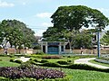 Công viên Trúc Giang
 -
 Kênh Chợ Lách
 -
 Cồn Phụng Hotel
 -
 Tân Thạch Communal House
 -
 Memorial stele
Trương Vĩnh Ký -
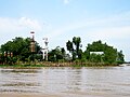 Reserves of Đạo Dừa
at Con Phung -
 Congregation Church
Christ the King -
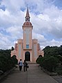 Church of Our Lady
Roman -
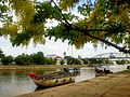
 Tourist boats dock at Con Phung wharf on Tiền River
 -
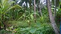 The coconut garden is green thanks to alluvium
 -
 Coconut is a large-scale and popular crop grown in bến Tre


References
[edit]- ^ Biểu số 4.6: Hiện trạng sử dụng đất vùng Đồng Bằng Sông Cửu Long năm 2022 [Table 4.6: Current land use status in the Mekong Delta in 2022] (PDF) (Decision 3048/QĐ-BTNMT) (in Vietnamese). Ministry of Natural Resources and Environment (Vietnam). 18 October 2023. – the data in the report are in hectares, rounded to integers
- ^ "Tình hình kinh tế, xã hội Bến Tre năm 2018". Cổng thông tin điện tử tỉnh Bến Tre. Retrieved 10 May 2020.
- ^ Ngọc Bữu, Lê (2001). Books Teaching materials for local history program for Bến Tre province's secondary school (in Vietnamese). Vietnam Education Publishing House.
- ^ Pringle, James, "Meanwhile: The quiet town where the Vietnam War began", The New York Times, 223 March 2004
- ^ Asselin, Pierre (2013). Hanoi's Road to the Vietnam War, 1954–1965. Berkeley: University of California Press. p. 73.
- ^ "Mekong Delta: more flood and drought" Archived May 5, 2010, at the Wayback Machine. VietnamNet Bridge. 19 March 2009.
- ^ "InformationBenTre - View Item". en.bentre.gov.vn. Retrieved 2024-08-19.
- ^ "InformationBenTre - View Item". en.bentre.gov.vn. Retrieved 2024-08-19.
External links
[edit]- Bến Tre website (in English)
- Bến Tre website Archived 2014-11-03 at the Wayback Machine (in Vietnamese)
- Bến Tre province profile
- Website Thành phố Bến Tre - Ben Tre City
Places adjacent to Bến Tre province | |
|---|---|
| International | |
|---|---|
| National | |